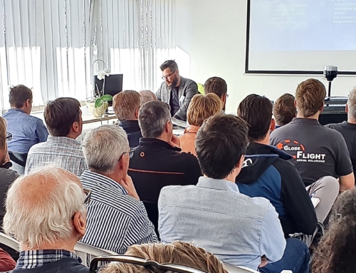
But don't worry, cheap doesn't mean worthless! Our philosophy is not the all-rounder overloaded with functions and hardly affordable, but the constant further development and maturing of the product geared to customer needs. In addition, we aim to design the software in such a way that you can get a quick result intuitively with just a few clicks.
The "CADdy V" plugin, which is seamlessly integrated into the familiar interface, expands the basic CAD BricsCAD V22 (and backwards compatible up to V17) with valuable functions and industry models for the areas of surveying, DTM, point clouds, longitudinal and transverse profiles, volume calculation and plan design . It supports you in the creation and analysis of even complex terrain or planning situations. Regardless of whether you use the DTM to create the basis for further planning and calculations or whether you are aiming for evaluations such as quantity determination or visualization.
BricsCAD CADdy V offers you the following features, among others:
– Import and export of various coordinate, measurement data and point cloud formats
– Creation of survey points in DXF/DW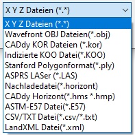 G as-built plans via block selection or at support points of lines and polygons
– Coordinate and point number management with numerous editing functions
– intelligent line connections between survey points
– Output in GeoPackage format
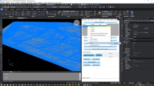 – Calculation of digital terrain models as a triangular network, including the incorporation of break lines, inner rings and rings
– Incorporation of points and editing of the triangle model by the user, also in an oblique view
– Additional information about the DTM and terrain is displayed
– Convenient horizon management with retrieval of information about the DTM and the terrain
– Contour lines can be calculated at any interval and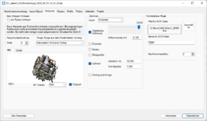 nd representation in the drawing
– Volume calculation also via definable sections of the model
– Create longitudinal and cross profiles for axes with support, while intervals, additional stations and distances can be freely defined
– Embankment display
– Plan frame with coordinate labeling and grid
– Coordinate transformations via country-specific transformation approaches
– Helmert/7-parameter transform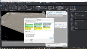 mation
– Thinning out of terrain models or point clouds to a size relevant to practice, which significantly reduces the effort involved in manual post-processing