TerraCADdy GIS
Terra CADdy GIS is a powerful tool for:
- Capture
- Administer
- visualize
- Analyze
from almost unlimited amounts of data in any number of individually switchable maps for linking to databases, for the spatial visualization of business events, documentation of lines, roads, grassland, cadastre, etc. and representation of business processes to route planning and route guidance (navigation).
Feature Overview:
- TerraCADdyGIS is an ideal tool to visualize data that have a spatial reference (addresses, sales areas, location information, POIs, lines, cadastre, measured values, etc.) according to certain specifications
- The hybrid data concept (vector and raster data) in combination with the object-oriented approach enables completely new ways of visualizing and managing large amounts of data.
- Free database connection - every object can be linked to any database and evaluations can be displayed in a structured color on the map
- Simple design aids (CAD) allow even the skilled draftsman a quick training and efficient work.
- Object manager - every geometry is clearly recorded as an object. This means that you decide whether the areas you have drawn are a customer address, an administrative district or a building, and note down the information required for this property type, e.g. use, owner, phone number. etc. directly when capturing or reading in.
- Online connection of maps on OGC-capable servers (eg surveying, NASA or World Mapping Service)
- Adding card topics and management via the project manager.
- Address finder for quick search of addresses or geocoding of address stocks
- Viewer: In order to visualize your data, any combinable themes, different projections and coordinate systems can be set simultaneously. With just two mouse clicks, you can create your own product including viewer from your TerraCADdyJGIS project. The user of the viewer can view the data provided by you, but has no editing options. Use the viewer to prepare your projects for demonstration purposes or to bring your own consumer products to the market.
- For scaled layout output use the extensive print and plot functions. Multiple print layout for output to PDF or Postscript for further processing in prepress products (Adobe Illustrtor, CorelDraw etc.) for professional card production
- Map Editor: Extensive design options from the CAD world are available to create your own maps. Automatic street and object placement, towing texts, copying and sharing of objects, fixing of object texts, attribution administration, house number placement, etc. help to produce sophisticated maps without much prior knowledge.
- Snap modes for fast and accurate construction
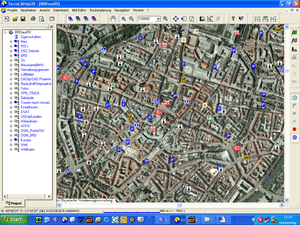
- Image editor: To fit any number of raster maps such as aerial photographs or topographic maps via control points or “Word files”
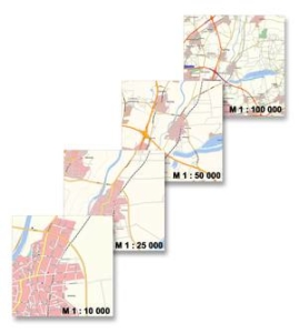
- Layout Manager: A novel layout technology allows you to customize the cards to your liking, adapted and depending on the visualization scale
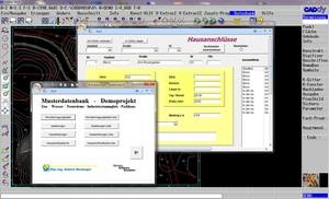
- Document database: Any documents can be placed in the graphic using the Windows drag & drop function. This can be an Excel, Word, email or even a media player document. Optionally, any databases can also be linked via an attribute (e.g. customer, tour, hotel or line databases). This allows free queries to be visualized and database forms to be opened. Any number of link attributes can be assigned to each object. The basic version of TerraCADdyJGIS is therefore the ideal tool for the geo-referenced management of damage, line, route, document and image databases.
- Routing option: enables routing and route guidance on the supplied road database from Scout Geomatics / * optional Teleatlas (R). The routing information is kept in the background. This means that you can visually route to any database that is visible in the foreground (e.g. cadastre, aerial photo, satellite image or rastered topographic maps or own maps). In addition, each own database can be routinely calculated in a service option.
- GPS Manager: With the help of this GPS module, you can view your current position, or even record rides, hiking and biking tours.
TerraCADdy GIS thus becomes the most universal geographic information system in its class.
Another strength of CADdy GIS is the modular design and the versatile expansion options that are possible without major programming and adjustments.


