TerraCADdy JGIS Viewer
The CADdy JGIS Viewer is used to visualize projects that have been exported using the Pack & Go function. The data is converted into a proprietary format and can no longer be edited.
Layout settings are locked.
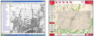
City Atlas Munich digital
The "digital city atlas Munich" can be easily started and operated by the DVD / Stick. An installation is therefore not necessary. Much faster data preparation, when the project is copied to the hard drive.
The data is presented in the CADdy viewer, which is an extract from the CADdy GIS comprehensive graphical information system. Accordingly, the operating functions are also based on this GIS system and therefore also largely correspond to the standard for the comprehensive operation of graphic information systems.
For easier handling of the software there is a second user interface. This provides all basic functions and allows an intuitive and easy time travel through the 850-year history of Munich.
The basis for all information is a current city map from the Wenning Geodatabase for Greater Munich. All maps have been fitted on the basis of this database, as far as technically possible. For individual maps was also fitted on the basis of the cadastre. POI's were usually fitted on the basis of the aerial photographs or the TK50.
If overlaps occur on the sheet edges of tile projects, this can be caused by different projections of the output cards.
All cards are divided into groups and arranged according to the year of manufacture. The card type can also be taken from the card name. Information on this can be found using the right mouse button and the map properties.
General overview of the functions of the viewer technology:
TerraCADdy JGIS is an ideal tool to visualize, manage and evaluate geodata and topographic maps in any combination.
The operation:
The application can be controlled by two different user interfaces:
1. Full functionality
- The user interface consists of a menu bar, a project tree and the map window
- In the project tree, all maps and aerial photographs are shown as a project group and arranged chronologically
- The groups, but also the individual cards within a project group can be switched on and off
- By connecting a database, information can be retrieved for each card:
- Default database: Sights and POIs of Munich
- Document database: Further information
- Company Database: Advertising entries of long-established companies from Munich
- The menu bar contains functions that allow you to move, zoom in, zoom out, search for addresses or even select a database
- Route planning is possible in the included city map
- With a connected GPS receiver, the map of Munich is navigable
- Length and area measurement
2. basic functionality
- The second user interface contains only the basic functionalities and is therefore easier to use
- It still contains all map content
- The different maps are also arranged chronologically and can be switched on and off
- A simplified menu bar allows zooming and moving maps
The data management:
- Through the hybrid data concept The current road network is connected to the various maps in raster format
- Due to the possibility of a database connection Any object can be linked to any database
- Any extension of maps and database topics in special projects
EU Atlas
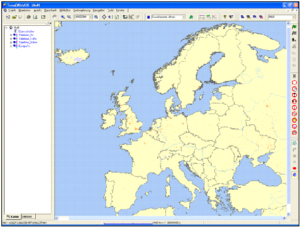
TerraCADdy EU Atlas presents the European space based on powerful viewer technology and a variety of current geospatial reference data. All data is always included. Even without internet connection, you remain flexible.
The following features are offered by the digital atlas:
- Can be used on any notebook and PC - plug in and off you go!
- no installation necessary
- current TomTom© Maps
- GPS capable - automatic map updates
- Information about hotels, restaurants, workshops, petrol stations, shopping facilities and much more from all over Europe in our own database
The data is presented in the CADdy viewer, which is an extract from the CADdy GIS comprehensive graphical information system. The operating functions have been taken over from this GIS and thus comply with the standard for the comprehensive operation of graphic information systems.
The map base consists of the current TomTom© Maps. In addition, important POIs of various categories are presented by symbols in the map.
Feature Overview:
- TerraCADdyGIS Viewer is an ideal tool to visualize and evaluate geospatial reference data in any combination
- The menu bar contains functions that allow you to move, zoom in, zoom out, search for addresses or even select a database
- With a connected GPS receiver, the maps are navigable (without route guidance)
- The integrated location and street search helps to zoom with a few mouse clicks to a specific address
- The project is complemented by a variety of Points of Interest (POI), eg:
- Hotels
- Restaurants
- gas stations
- Churches
- Length and area measurement
- The street and topography data of TeleAtlas© are integrated as vector data in the viewer
- All cards can be output from the printer. Using the layout editor, you can manage your own layouts for print and screen
Germany - Atlas
TerraCADdy Deutschland Viewer is a powerful tool:
- current road data of Germany
- Location and street search
- Navigation and route planning
- Current high-resolution official aerial photos *
- Current official cadastral data *
- Current official topographic maps *
* Internet connection required
With the Germany Viewer you get in a package a variety of the latest geobasis data. Among other things, the latest vector road data, aerial photos and the official cadastre. This was made possible, for example, by the cooperation with the Bavarian State Office for Surveying and Geoinformation and the largest navigation data provider TeleAtlas. Together with the TerraGIS viewer technology, all individual card themes can be combined in almost any way and create hybrid map views.
Feature Overview:
- TerraCADdyGIS Viewer is an ideal tool for visualizing and evaluating geospatial reference data over a large area in any combination.
- by the hybrid data concept (Vector and raster data) combine, for example, the current road network, as of July 2008, with an aerial view or cadastre. The aerial and cadastral data are up to date, as they load this data online directly from the server of the offices. In no time you can orient yourself or read cadastral information.
- the integrated, house number accurate Location and street search help them to zoom to a specific address with just a few mouse clicks.
- If you have an existing GPS receiver, you can also navigate from the Germany viewer or have it displayed in the map, wherever you are:
- on which plot am I?
- In which street am I?
- what does my location look like from the air?
- The product is complemented by a variety of points of interest (POI)
- Parking lots, gas stations, restaurants, swimming pools, churches etc.
- Thanks to their ease of use, they can start immediately without any training or additional specialist knowledge.
Usage model of the Germany viewer:
- For the monthly basic price of 39 Euro you already get many Mapviews, which will be charged with this basic price *
- If the costs of the mapviews exceed this basic price, they will be calculated exactly. You only pay for what you use! *
- The Mapviews can also be used in the software TerraCADdy GIS or CADdy
- The street data of Tele Atlas can be used indefinitely in the Bayern Viewer
* Cost of mapviews depending on the individual offices
Geo viewer:
- the D-Viewer is a derivative of the TerraCADdy GIS software
- The viewer has no editing options, but only serves to visualize maps and is therefore inexpensive
- The road data is routable, so that a route calculation between several points is possible
- the viewer can perform navigation functions in conjunction with a GPS receiver
Card Technology:
- the official maps are loaded via the OGC interface of the viewer directly from the server of the office into the map window
- every time you zoom in or move the map, the viewer sends the coordinate window to our server, who then fetches the corresponding map section and passes it on to the viewer
- the Wenninger web service handles all counting processes per customer and per card
- Ingenieurbüro Wenninger takes over the complete billing with the Bavarian State Office for Surveying and Geoinformation
- The street and topography data of the company Tele Atlas are integrated as vector data in the viewer and can be used arbitrarily
- the Ingenieurbüro Wenninger is the official provider of the Tele Atlas Multinet-Europe data and therefore also the contact person for questions about this data
- The layout of the vector data integrated in the viewer was designed by Ingenieurbüro Wenninger
- The layout is optimized so that, depending on the scale, a map image that makes sense from a cartographic point of view is displayed
We are happy to put together a map viewer according to your wishes. In addition to all German federal states, we also research all official data available Europe-wide for you.
Already available are: Bavaria, Hesse, Saxony, Baden-Wuerttemberg, NRW, South Tyrol


