WebCADdy goes 3D!
In future you can view your data in the 3D view. Regardless of whether measured, self-drawn or imported.
The time has come soon: WebCADdy brings your maps into the third dimension.
With Cesium it will be possible to view your data in a 3D view, regardless of whether your elevation data are ellipsoidal or above sea level heights.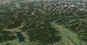 With the import functions integrated in WebCADdy, it does not matter in which original coordinate system your data is available. It is only important at this point that the data to be visualized know an altitude.
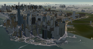
Import your data or create your own objects in the 2D view and view them in the 3D view. For you as a user, the 3D functionality does not change your usual way of working. Even after the introduction of the 3D view, you can create measurements, objects, types or thematic maps as usual and view them in three dimensions.
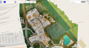
Shuffle your cards again. The future WMS administration in WebCADdy allows you to combine WMS services as you wish. Drone pilots can also look forward to the opportunity to incorporate daily aerial photos.
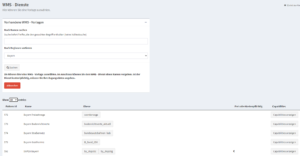
A significantly expanded WMS administration will soon be available. The new WMS administration enables you to use templates or your own known WMS services to create your own map material as basic maps in WebCADdy. In addition, it will be possible to conveniently connect individual levels of a WMS service.
The new WMS administration will allow you to combine a large number of WMS services as overlays, provided the respective WMS service supports this.
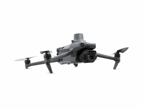
Another very interesting innovation is being planned, especially for the drone pilots:
WebCADdy will soon offer you the option of storing your own aerial photos as WMS. For this, an image with a world file is required, which you can obtain, for example, by evaluating a drone flight using a 3D survey. But other images that are available in this format are also imported and used as a WMS service in WebCADdy
can be displayed. With this functionality you will be able to always have daily updated aerial photos of a gravel pit or construction site, for example.