![]()
![]()
OVERVIEW
What's new:
- improved algorithm for calculating the point cloud
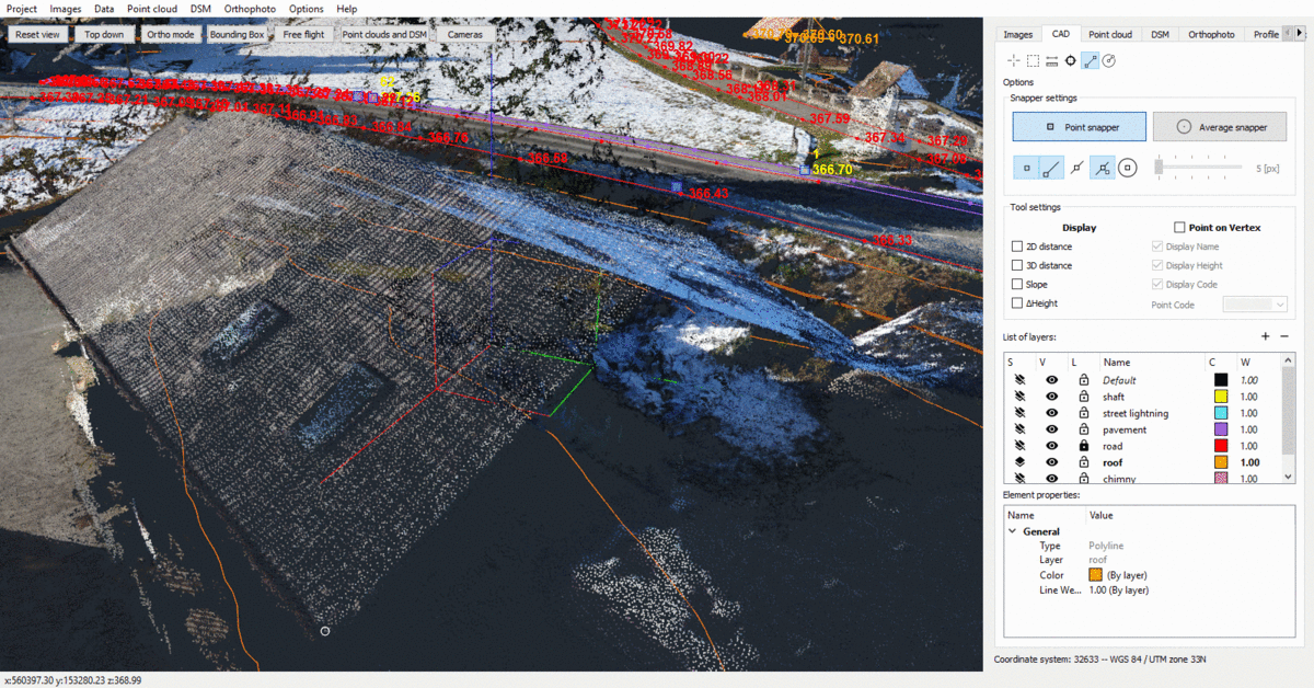
- new CAD functions (point, measurements, fishing opportunities)
- 3D video recording (animations)
- Support for several different cameras in one project
- View and edit camera parameters
- Set geoid when importing telemetry
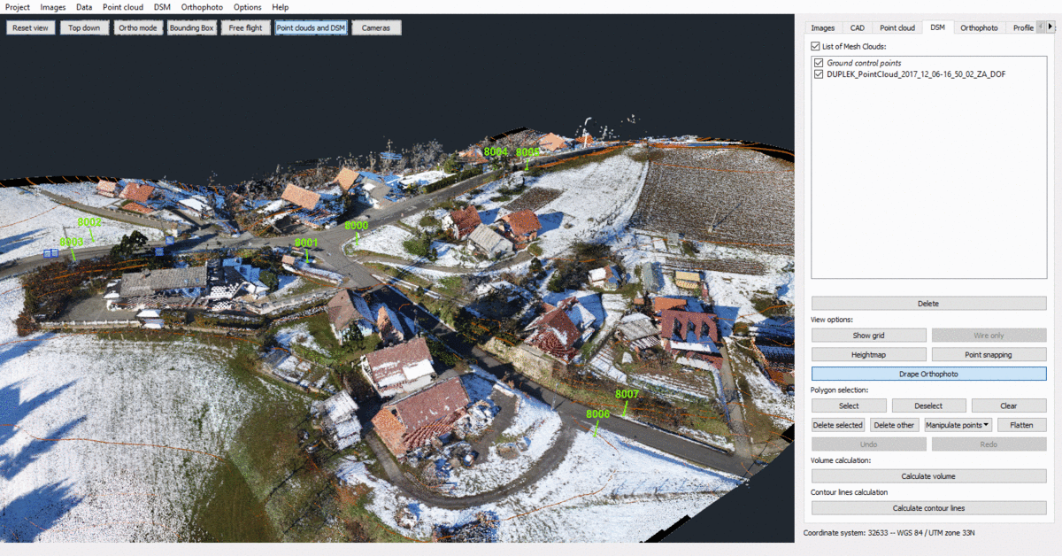
- Control points renamed Control Points.
- enlarge with a double click
- rotatable drawing box
- new languages of the user interface (Turkish and Spanish)
What has been revised:
- Problems when importing the LAS format fixed
- Problems when exporting the LAS format fixed
- Consider the CAD line thickness when exporting orthophotos
- Consideration of the visibility of CAD layers when exporting orthophotos
- Removed Orthopedic Restriction Restricting Resolution to less than 1 cm.
- Corrected textured object calculation when using GPU for point cloud calculation
Known problems:
- Software no longer supports loading projects from 3Dsurvey v2.3 or older
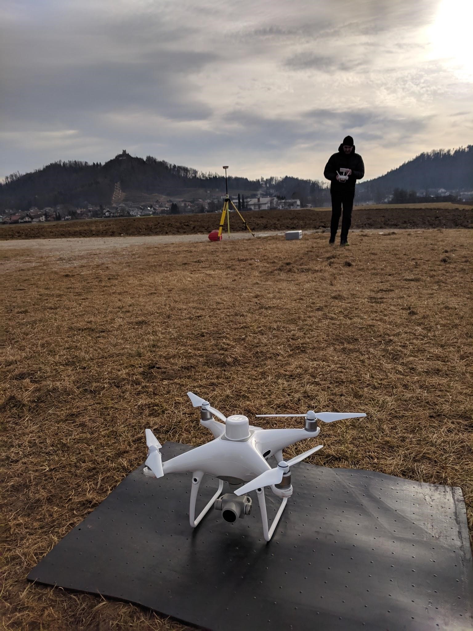
1. Full RTK & PPK support (Phantom 4 RTK, RTK Fixedwing UAVs, ...)
- Improved orientation algorithm and geoid support
- Now able to achieve the accuracy of survey grades without the use of GCP points.
- CM Grade Geo referencing and model orientation based on drone telemetry only!
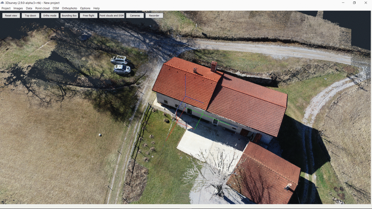
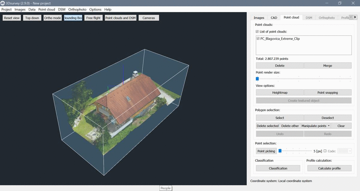
2. SIGN BOX
- Turn the drawing box around any axis
- Adjust the view to any detail using the bounding box, regardless of the shape, scale, and orientation in the point cloud.
3. VIDEO RECORDING ANIMATIONS
- Create stunning video animations in 3D Survey and export videos as MP4 file format.
- Switch between different view options in real time during rendering.
- Share your results with your customers in a simple and highly representative way.
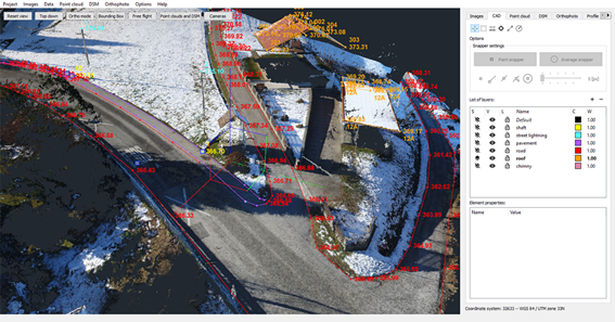
4. IMPROVED CAD FUNCTIONS
- Create new points that are displayed with name, height and code.
- Join 3D lines with vertices, measure distances, or export CAD results in DXF file format.
- Now you have all the CAD tools to prepare your data for creating overview maps.
5. IMPROVED VIEW OPTIONS
- Pan the model to cross the center and zoom in with a simple "double click".
- Arrange in no time in your field of interest!
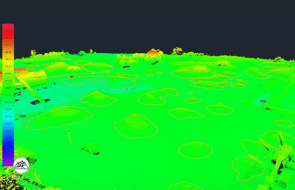
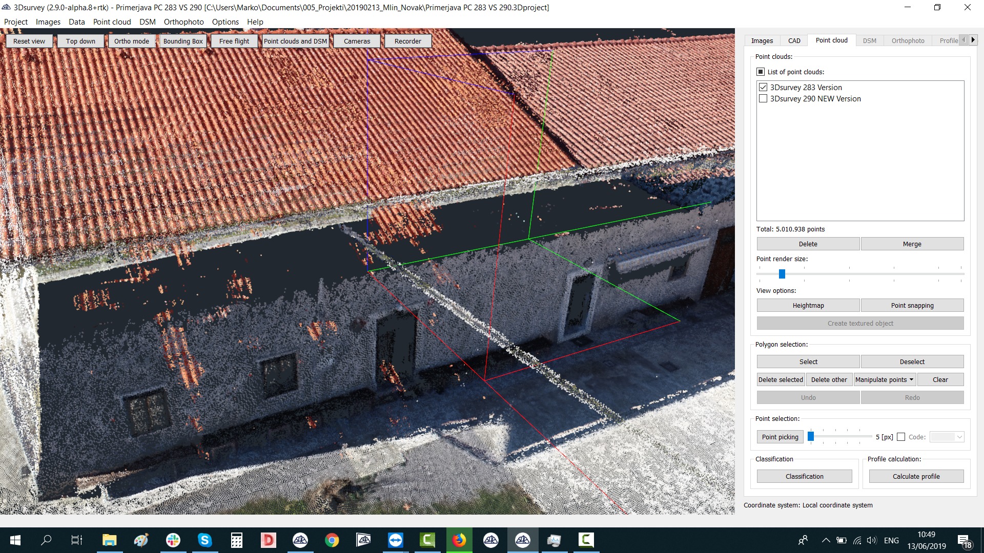
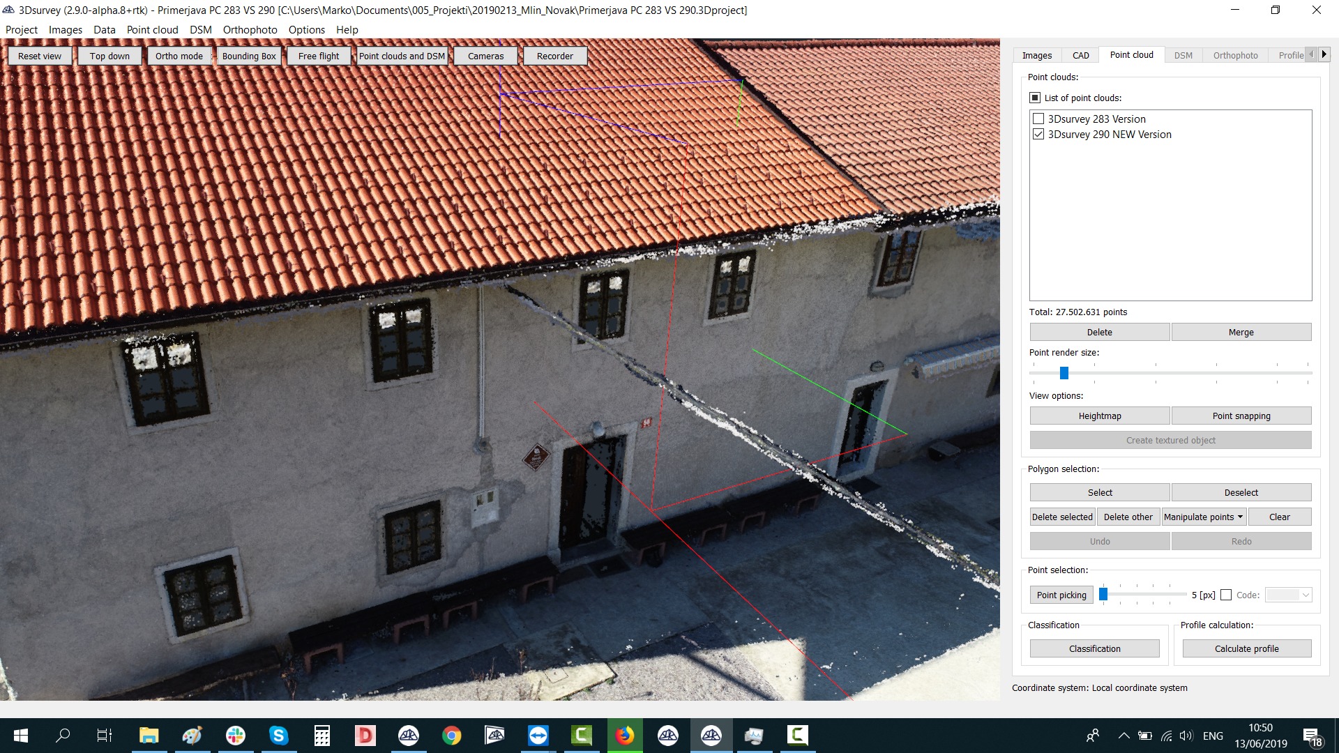
6. MORE IMPROVED SPOT WOOD PROCESSING AND DENSITY RECONSTRUCTION
- Calculate point cloud on EXTREME level on low-powered graphics cards (NVIDIA support only)
- Achieve highly detailed results with 3Dsurvey dense reconstruction algorithm. To achieve astonishing results add some side images and process all together in a single project
- Calculation of point cloud at EXTREME level even on low performance graphics cards (NVIDIA support only)
- Achieve highly detailed results with the 3Dsurvey reconstruction reconstruction algorithm. For amazing results, add some page images and process all images in a single project.
BEFORE
NOW
- Mass / priorities are now used for even better feature extraction and accuracy.
- Support for several different cameras in one project
- View and edit camera parameters