In this article we will show you the advantages of capturing a construction site with a UAV and 3Dsurvey.
We will show you all the necessary steps how you can carry out construction progress monitoring with a UAV (DJI P4RTK) a GNSS receiver (Emlid Reach RS2) and 3Dsurvey in the future.

Problem & solution
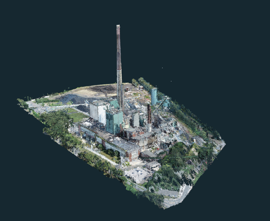
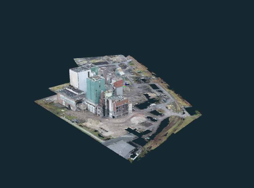
In our case, it is a very large demolition site. The area is approx. 400.000 m² and the volume of the buildings around 1.000.000 m³.
Problem for classic surveying
• The single point recording would be too time-consuming.
• too many details
• The presentation of the results on the basis of a 3D site plan was not sufficient for the client.
Solution
UAV data can be recorded very quickly and are much more detailed and clear.
It's a safer, faster, and more efficient option for construction companies who need to monitor their construction progress and make the data available to everyone
Flight planning for construction progress
We used different flight plans for the data acquisition
In order to document the original condition, we used the inclined surface planning of the DJI P4RTK, so that we can also map the chimneys.
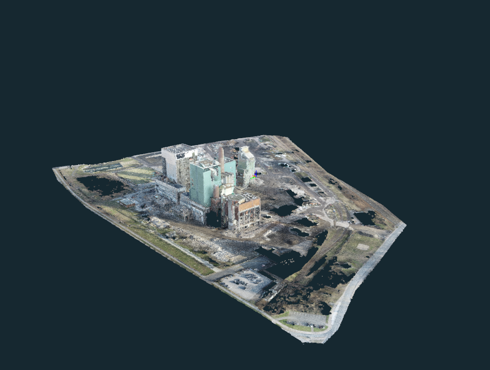
The intermediate results in December, January and February were created from the 3D flight planning with a 70 degree camera angle, whereby the chimneys were left out in the planning.


Evaluation with 3Dsurvey
Our goals:
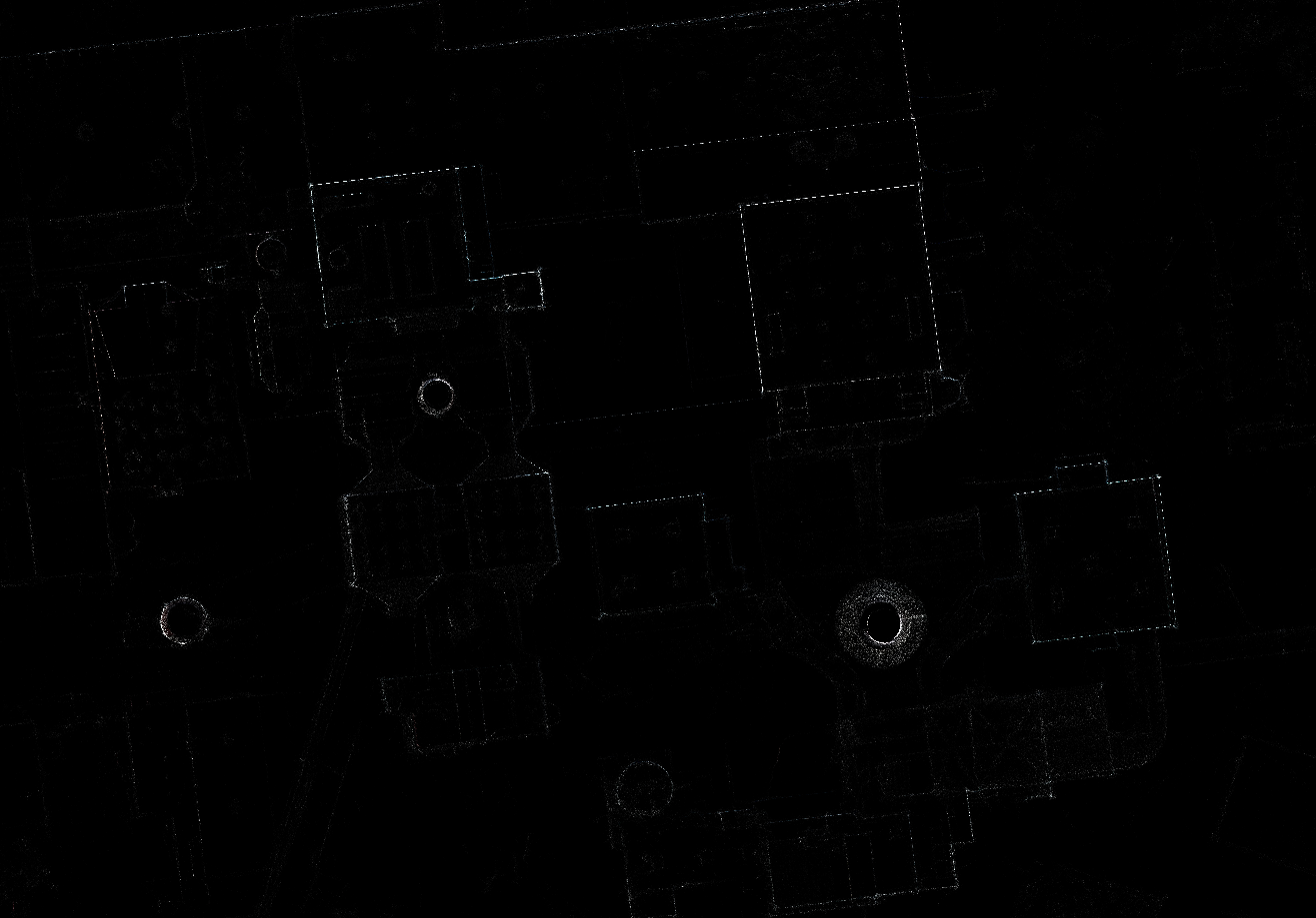
1. Create a building plan from the Xray
2. Create a 3D model for the presentation
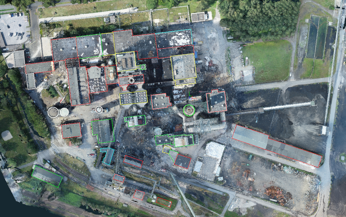
3. Creation of a 3D model for tracking the progress in the different areas